
March 8, 2014: Starting in Ashland, I drove to the East Coast and in one day, grabbed the winter highpoints of Massachusetts (Mt. Greylock), Connecticut (Mt. Frissell-South Slope) and High Point (New Jersey), respectively.
Here’s the recap:
Up from my smoking northeastern Massachusetts motel room at 6 a.m. I went to bed five hours earlier after nine-plus hours of driving.
I finished a continental breakfast (even at a $50-buck-a-night dive) then drove another 32 minutes through the town of Adams and up the mountain road past the deserted flower shop to the vacant muddy trailhead parking lot. I smelled the staying and stagnate stench of sled-head fumes.
After a small bit of trekking, I saw the sign that read, “Cheshire Harbor Trail, 3.5 miles to Summit.”
Grrr. My research led me to believe in was two miles max with hardly any grade. It’s not that a 7-mile roundtrip is that long, it’s just that I was on a quest to get at least three state highpoints.
Maybe I needed to realize hiking and climbing were about your relationship to nature and about enjoying what you’re doing. It was not about time and distance, bragging and notoriety. I like both approaches.
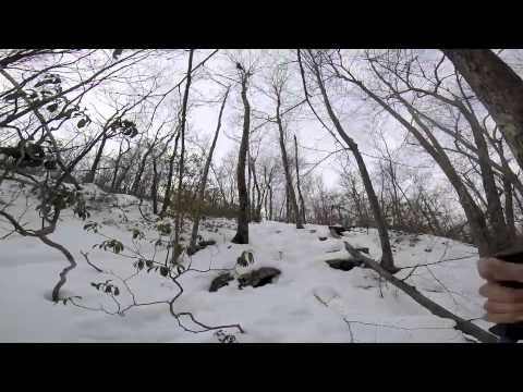
The Harbor Trail was a snowmobiled-out wide and steady hike to the top (micros would have been nice, but definitely glad I left my crampons). The view looks into flat plains of civilization’s wrath. There’s a neat monument at the top resembling the Washington monument, cold and phallic.
I was totally alone at the top — like I was for Backbone Mountain (and by day’s end, Mt. Frissell too). My cousin and I didn’t share Mt. Marcy’s top with any other climbers and it was the same with my team on Mt. Washington. I’m finding that if you’re up early and hiking in the winter, the mountain is all yours.
My biggest regret was that I didn’t pack my snowboard up to the Greylock summit. Since Harbor Trail is so wide, you could easily have an amazing, 3.5-mile uninterrupted glide down. But I’m sure there are some “super sic” backcountry routes where you could get into some more serious ‘derrrrrrrrr.
Back in the car, I had an energy-bars-and-water brunch. Soon, I was off of the paved road, but it was a little bit tricky navigating to the trailhead for Mt. Frissell.
“Stay straight, and follow what looks to be the most dominant road,” I remember reading somewhere — whatever the hell that meant.
The dirt road was closed at the Mt. Frissell trailhead during winter, which was also the state line of Connecticut and Massachusetts, so my atlas and I were confused but found the trailhead.
Mount Frissell was great because even though it was not a high mountain, you have to ascend two separate summit cones. Hence, you get the illusion of real climbing. Because it’s a shoulder, the “summit” is really just a highpoint marker.

After 2.5 hours of hiking, I reached the car with heavy fatigue, sleep deprivation and headed for the New Jersey highpoint (called High Point). I polished off a late lunch/early dinner of gas station grossness— more bars, muffins, chips, and energy drinks.
It was getting dark but the gates were open and I watched the smog set at the top of New Jersey.
Shortly after my “summit” photo, a park officer in an SUV with too many guns approached me.

“We’re shutting ‘er down,” he said.
“What, you’re closing nature?” I asked.
“We close at 4:30, it’s almost 5.”
“Ummm, OK. Like, sorry?”
I understand it’s a state park, but why do State Parks have hours? Are the squirrels complaining about the sleeping bags ruffling at 2 a.m.?
The need to constantly regulate, ugh. And therein lies the big glaring difference between hiking/climbing and highpointing. Location.
Here’s a pretty cringe 5 min video of the trip:
Read HP #9:
Full moon hike perfect backdrop for West Virginia summit
