
“And the iron boats go as the mariners all know with the gales of November remembered.” — Gordon Lightfoot, “The Wreck of the Edmund Fitzgerald.”
Six giant ore boats anchored and sought refuge Friday night and into Saturday in the harbor between Vermillion and Sandusky as Winter Storm Gerri howled across the Great Lakes — and north central Ohio.
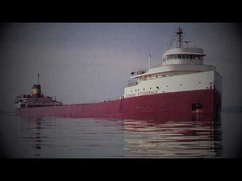
Perhaps it’s from lessons learned after the Nov. 10, 1975, tragedy in much deeper Lake Superior when the 729-foot SS Edmund Fitzgerald went down in a storm, a tragedy that cost the lives of all 29 crew members aboard.
Conditions on Lake Erie are not getting much better today on waters beyond five nautical miles of shore on Lake Erie.
According to the National Weather Service office in Cleveland, southwest gales of 40 to 45 knots are expected Saturday with waves building to 13 feet and some occasionally around 16 feet.

No one can say the weather impacting the region was unexpected. This storm is not a big snow event for us. This is one is all about the wind and cold.
Forecasters have warned us for several days of the coming high winds, bitter chills and spitting snow that we could expect across north central Ohio.
Here is what we know as of Saturday morning:
Wind child advisory in effect tonight
A wind child advisory will go into effect at midnight and last until Sunday at 4 p.m. as the anticipated arctic airmass arrives.
Very cold wind chills, some as low as 15 below zero, are expected during the period, generally along and west of Interstate 71
Gusty winds across the region will limit recovery on Sunday and wind chill values well below zero will continue Sunday night and into next week. Extensions of the wind chill advisory will be likely.
Folks are urged to use caution while traveling outside. Wear appropriate clothing, hats and gloves.
High wind warning in effect Saturday
A high wind warning across the area remain in effect Saturday until 7 p.m.
Expect southwest winds of 25 to 35 mph with gusts up to 60.
Damaging winds will blow down trees and power lines. Widespread power outages are expected. Travel will be difficult, especially for high profile vehicles.
The NWS said people should avoid being outside in forested areas and around trees and branches. If possible, remain in the lower levels of your home during the windstorm, and avoid windows. Use caution if you must drive.
Richland County EMA Director Rebecca Owens has announced there are a couple of warming shelters available this weekend in the City of Mansfield.

Here is a look at at the next several days in terms of weather:
Sunday
Cloudy, then gradually becoming mostly sunny and cold, with a high near 10. Wind chill values as low as -15. Breezy, with a west wind 18 to 23 mph, with gusts as high as 39 mph.
Sunday Night
Mostly cloudy, with a low around 1. Wind chill values as low as -16. Southwest wind 10 to 16 mph, with gusts as high as 26 mph.
Monday
Mostly cloudy, with a high near 12. Southwest wind around 10 mph.
Monday Night
A slight chance of snow showers. Mostly cloudy, with a low around 4. Chance of precipitation is 20%.
Tuesday
A chance of snow showers. Mostly cloudy, with a high near 11. Chance of precipitation is 30%.
Tuesday Night
Mostly cloudy, with a low around 1.
Wednesday
Partly sunny, with a high near 15.
Wednesday Night
Mostly cloudy, with a low around 11.
Thursday
A chance of snow showers. Mostly cloudy, with a high near 21. Chance of precipitation is 30%.
Thursday Night
A chance of snow showers. Mostly cloudy, with a low around 12. Chance of precipitation is 40%.
Friday
A chance of snow showers. Mostly cloudy, with a high near 21. Chance of precipitation is 30%.
And an FYI — The Weather Channel is warning that Winter Storm Heather is cuing up to roll into the Northwest this weekend, preparing for her own run across the country.
”